
Province of Huaylas topographic map
Interactive map
Click on the map to display elevation.
About this map
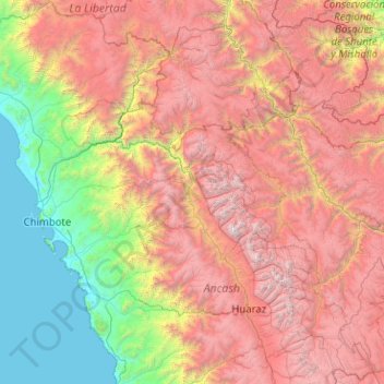
Name: Province of Huaylas topographic map, elevation, terrain.
Location: Province of Huaylas, Santa Cruz, Huaylas, Ancash, Peru (-8.93879 -77.84906 -8.89879 -77.80906)
Average elevation: 2,353 m
Minimum elevation: 1,902 m
Maximum elevation: 3,143 m
Other topographic maps
Click on a map to view its topography, its elevation and its terrain.
Alpamayo
Peru > Ancash > Santa Cruz
Alpamayo, Santa Cruz, Huaylas, Ancash, Peru
Average elevation: 5,210 m