
Stiperstones topographic map
Interactive map
Click on the map to display elevation.
About this map
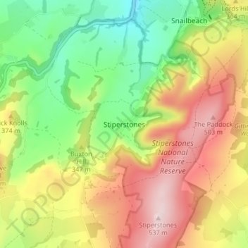
Name: Stiperstones topographic map, elevation, terrain.
Location: Stiperstones, Shropshire, England, SY5 0NA, United Kingdom (52.57706 -2.96391 52.61706 -2.92391)
Average elevation: 327 m
Minimum elevation: 152 m
Maximum elevation: 527 m
Other topographic maps
Click on a map to view its topography, its elevation and its terrain.
Walford
United Kingdom > England > Shropshire
Walford, Baschurch, Shropshire, England, SY4 2HR, United Kingdom
Average elevation: 83 m
Hordley
United Kingdom > England > Shropshire
Hordley, Shropshire, England, SY12 9BB, United Kingdom
Average elevation: 87 m