
Shillong topographic map
Interactive map
Click on the map to display elevation.
About this map
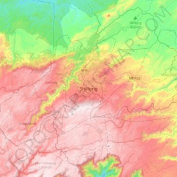
Name: Shillong topographic map, elevation, terrain.
Location: Shillong, East Khasi Hills, Meghalaya, 793001, Indien (25.41602 91.72280 25.73602 92.04280)
Average elevation: 1,351 m
Minimum elevation: 659 m
Maximum elevation: 1,956 m