
Jokkmokks kommun topographic map
Interactive map
Click on the map to display elevation.
About this map
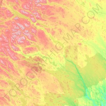
Name: Jokkmokks kommun topographic map, elevation, terrain.
Location: Jokkmokks kommun, Norrbotten County, Sweden (65.90918 16.08983 67.90581 21.27410)
Average elevation: 538 m
Minimum elevation: 8 m
Maximum elevation: 2,015 m
Other topographic maps
Click on a map to view its topography, its elevation and its terrain.
Harju
Sweden > Norrbotten County > Harju
Harju, Haparanda kommun, Norrbotten County, 95393, Sweden
Average elevation: 34 m
Gällivare kommun
Gällivare kommun, Norrbotten County, Sweden
Average elevation: 486 m
Gällivare
Gällivare, Gällivare kommun, Norrbotten County, 982 31, Sweden
Average elevation: 403 m