
Tỉnh Long An topographic map
Interactive map
Click on the map to display elevation.
About this map
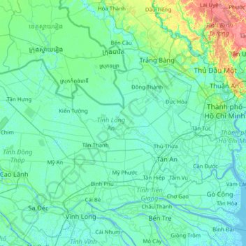
Name: Tỉnh Long An topographic map, elevation, terrain.
Location: Tỉnh Long An, Vietnam (10.39541 105.50372 11.03214 106.74571)
Average elevation: 6 m
Minimum elevation: -3 m
Maximum elevation: 63 m
Other topographic maps
Click on a map to view its topography, its elevation and its terrain.
Phường 1
Vietnam > Tỉnh Long An > Phường 1
Phường 1, Kiến Tường, Tỉnh Long An, Vietnam
Average elevation: 3 m