
Tỉnh Ninh Bình topographic map
Interactive map
Click on the map to display elevation.
About this map
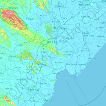
Name: Tỉnh Ninh Bình topographic map, elevation, terrain.
Location: Tỉnh Ninh Bình, Vietnam (19.69311 105.54170 20.45471 106.27368)
Average elevation: 20 m
Minimum elevation: -3 m
Maximum elevation: 607 m
Other topographic maps
Click on a map to view its topography, its elevation and its terrain.
Nationalpark Cúc Phương
Nationalpark Cúc Phương, Đường rừng Cúc Phương, Nho Quan, Tỉnh Ninh Bình, Vietnam
Average elevation: 160 m