
Nellore topographic map
Interactive map
Click on the map to display elevation.
About this map
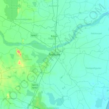
Name: Nellore topographic map, elevation, terrain.
Average elevation: 17 m
Minimum elevation: -1 m
Maximum elevation: 146 m
Nellore is located at 14°26′N 79°59′E / 14.44°N 79.98°E / 14.44; 79.98. It has an average elevation of 18 metres (59 ft).