
Thank you for supporting this site ❤️
Make a donation
Make a donation
Nazlet Al Siman and Al Sisi topographic map
Click on the map to display elevation.
Thank you for supporting this site ❤️
Make a donation
Make a donation
About this map
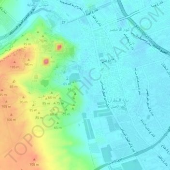
Name: Nazlet Al Siman and Al Sisi topographic map, elevation, terrain.
Location: Nazlet Al Siman and Al Sisi, Remaya Square, Giza, Egypt (29.95153 31.13269 29.98985 31.15742)
Average elevation: 42 m
Minimum elevation: 15 m
Maximum elevation: 126 m
Thank you for supporting this site ❤️
Make a donation
Make a donation