
Enghien-les-Bains topographic map
Interactive map
Click on the map to display elevation.
About this map
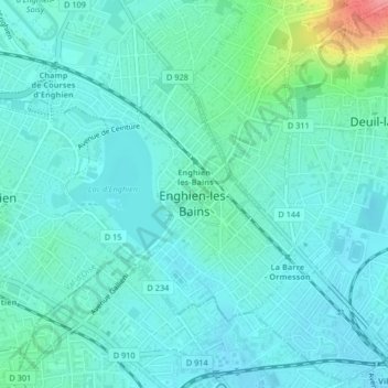
Name: Enghien-les-Bains topographic map, elevation, terrain.
Average elevation: 50 m
Minimum elevation: 34 m
Maximum elevation: 123 m
Other topographic maps
Click on a map to view its topography, its elevation and its terrain.
Hérouville-en-Vexin
France > Île-de-France > Val-d'Oise
Hérouville-en-Vexin, Pontoise, Val-d'Oise, Île-de-France, France métropolitaine, 95300, France
Average elevation: 104 m