
Mariscal Nieto topographic map
Interactive map
Click on the map to display elevation.
About this map
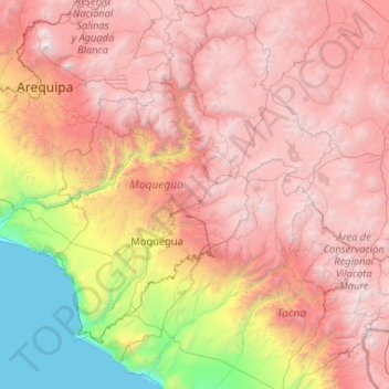
Name: Mariscal Nieto topographic map, elevation, terrain.
Location: Mariscal Nieto, Moquegua, Pérou (-17.95459 -71.73073 -15.95459 -69.73073)
Average elevation: 2,932 m
Minimum elevation: 0 m
Maximum elevation: 5,932 m
Other topographic maps
Click on a map to view its topography, its elevation and its terrain.
Alto de La Villa
Alto de La Villa, Moquegua, Mariscal Nieto, Moquegua, Pérou
Average elevation: 1,457 m
General Sánchez Cerro
General Sánchez Cerro, Matalaque, General Sánchez Cerro, Moquegua, Pérou
Average elevation: 3,660 m