
Aboi topographic map
Click on the map to display elevation.
About this map
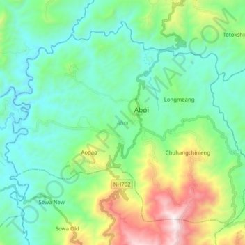
Name: Aboi topographic map, elevation, terrain.
Location: Aboi, Mon, Nagaland, India (26.53790 94.87879 26.65313 95.03447)
Average elevation: 652 m
Minimum elevation: 231 m
Maximum elevation: 1,922 m
Other topographic maps
Click on a map to view its topography, its elevation and its terrain.