
Chez Petit topographic map
Interactive map
Click on the map to display elevation.
About this map
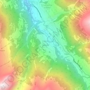
Name: Chez Petit topographic map, elevation, terrain.
Location: Chez Petit, Dranse, Liddes, Entremont, Valais, 1945, Suisse (45.96707 7.15873 46.00707 7.19873)
Average elevation: 1,685 m
Minimum elevation: 1,122 m
Maximum elevation: 2,462 m