
Diest topographic map
Interactive map
Click on the map to display elevation.
About this map
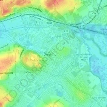
Name: Diest topographic map, elevation, terrain.
Location: Diest, Leuven, Vlaams-Brabant, België (50.97315 5.03248 50.99607 5.07006)
Average elevation: 29 m
Minimum elevation: 14 m
Maximum elevation: 65 m
Other topographic maps
Click on a map to view its topography, its elevation and its terrain.
Kaggevinne
België > Vlaams-Brabant > Leuven > Diest > Kaggevinne
Kaggevinne, Diest, Leuven, Vlaams-Brabant, Vlaanderen, 3293, België
Average elevation: 43 m