Geolocate

Poncebos topographic map

Click on the map to display elevation.

About this map

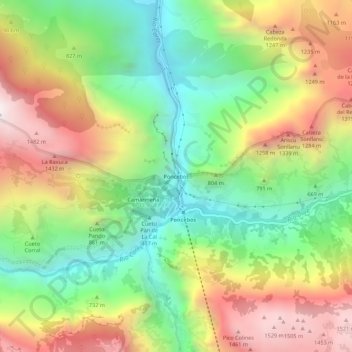
Name: Poncebos topographic map, elevation, terrain.

Location: Poncebos, Bulnes, Cabrales, Asturias, 33554, Spain (43.24178 -4.85140 43.28178 -4.81140)

Average elevation: 794 m

Minimum elevation: 174 m

Maximum elevation: 1,594 m

Other topographic maps

Click on a map to view its topography, its elevation and its terrain.

San Roque

Spain > Asturias > Cabrales

The altitude is 441 m (1,447 ft) above sea level. It is 20.87 km2 (8.06 sq mi) in size with a population of 199 (INE 2011). The postal code is 33555.

Average elevation: 737 m

Berodia

Spain > Asturias > Cabrales

Average elevation: 864 m

Arenas

Spain > Asturias > Cabrales

Average elevation: 670 m

Sotres

Spain > Asturias > Cabrales

Average elevation: 1,496 m