
Werchter topographic map
Interactive map
Click on the map to display elevation.
About this map
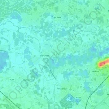
Name: Werchter topographic map, elevation, terrain.
Average elevation: 10 m
Minimum elevation: 3 m
Maximum elevation: 43 m
Werchter ligt aan de samenvloeiing van Demer en Dijle. In het noorden stroomt de Laak. De hoogte van Werchter bedraagt 10-15 meter. De bodem bestaat uit zand.
Other topographic maps
Click on a map to view its topography, its elevation and its terrain.
Wezemaal
België > Vlaams-Brabant > Leuven > Rotselaar
Wezemaal, Rotselaar, Leuven, Vlaams-Brabant, 3111, België
Average elevation: 22 m