Champex d'en haut topographic map
Interactive map
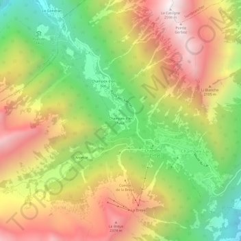
Click on the map to display elevation.
About this map
Name: Champex d'en haut topographic map, elevation, terrain.
Average elevation: 1,789 m
Minimum elevation: 1,020 m
Maximum elevation: 2,586 m

Click on the map to display elevation.
Name: Champex d'en haut topographic map, elevation, terrain.
Average elevation: 1,789 m
Minimum elevation: 1,020 m
Maximum elevation: 2,586 m