
Thank you for supporting this site ❤️
Make a donation
Make a donation
Alonzo topographic map
Click on the map to display elevation.
Thank you for supporting this site ❤️
Make a donation
Make a donation
About this map
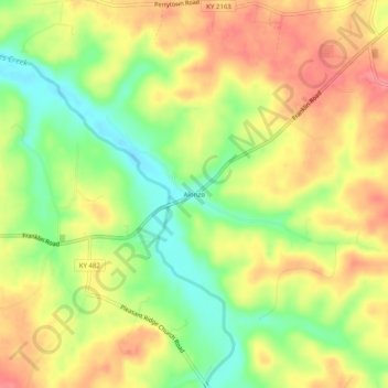
Name: Alonzo topographic map, elevation, terrain.
Location: Alonzo, Allen County, Kentucky, United States (36.67310 -86.36471 36.71310 -86.32471)
Average elevation: 214 m
Minimum elevation: 170 m
Maximum elevation: 252 m
Thank you for supporting this site ❤️
Make a donation
Make a donation
Other topographic maps
Click on a map to view its topography, its elevation and its terrain.