
Thank you for supporting this site ❤️
Make a donation
Make a donation
Carlos Ramos Loyza topographic map
Click on the map to display elevation.
Thank you for supporting this site ❤️
Make a donation
Make a donation
About this map
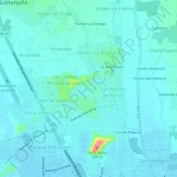
Name: Carlos Ramos Loyza topographic map, elevation, terrain.
Location: Carlos Ramos Loyza, Subtanjalla, Ica, 11000, Perú (-14.05818 -75.76072 -14.01818 -75.72072)
Average elevation: 418 m
Minimum elevation: 406 m
Maximum elevation: 518 m
Thank you for supporting this site ❤️
Make a donation
Make a donation