
Ulu Choh topographic map
Interactive map
Click on the map to display elevation.
About this map
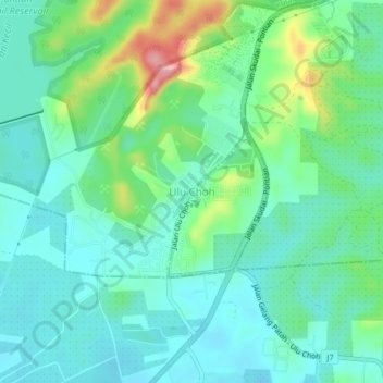
Name: Ulu Choh topographic map, elevation, terrain.
Location: Ulu Choh, Johor, 81500, Malaysia (1.51210 103.52615 1.55210 103.56615)
Average elevation: 50 m
Minimum elevation: 11 m
Maximum elevation: 167 m
Other topographic maps
Click on a map to view its topography, its elevation and its terrain.
Kampung Baru Ulu Choh
Kampung Baru Ulu Choh, Ulu Choh, Kulai, Iskandar Malaysia, Johor, Malaysia
Average elevation: 55 m