
Lamongan topographic map
Interactive map
Click on the map to display elevation.
About this map
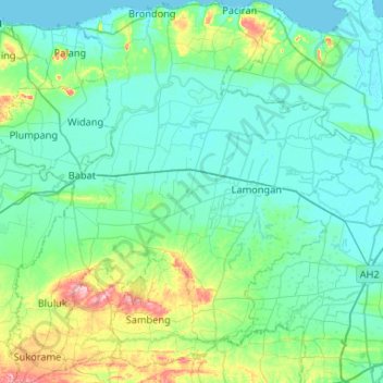
Name: Lamongan topographic map, elevation, terrain.
Location: Lamongan, Ost-Java, Indonesien (-7.38474 112.07256 -6.86113 112.55238)
Average elevation: 30 m
Minimum elevation: -1 m
Maximum elevation: 191 m