
Monceau-sur-Sambre topographic map
Interactive map
Click on the map to display elevation.
About this map
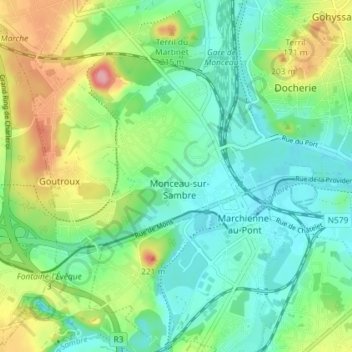
Name: Monceau-sur-Sambre topographic map, elevation, terrain.
Location: Monceau-sur-Sambre, Charleroi, Hainaut, Wallonie, Belgique (50.39068 4.35364 50.43708 4.39763)
Average elevation: 135 m
Minimum elevation: 97 m
Maximum elevation: 214 m
Other topographic maps
Click on a map to view its topography, its elevation and its terrain.