
Col du Grand Ballon topographic map
Interactive map
Click on the map to display elevation.
About this map
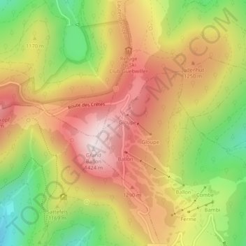
Name: Col du Grand Ballon topographic map, elevation, terrain.
Average elevation: 1,143 m
Minimum elevation: 820 m
Maximum elevation: 1,419 m
Der Große Belchen (französisch Grand Ballon) ist mit 1424 Metern Höhe der höchste Berg der Vogesen. Der Berg ist auch bekannt unter den Namen Sulzer oder Gebweiler Belchen (französisch Ballon de Guebwiller) nach den nächstliegenden Städten Soultz-Haut-Rhin (deutsch Sulz) und Guebwiller (deutsch Gebweiler) acht Kilometer östlich. Der Berg liegt im Regionalen Naturpark Ballons des Vosges.