
Sommet de l'Ardève topographic map
Interactive map
Click on the map to display elevation.
About this map
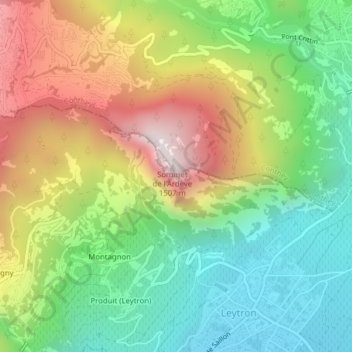
Name: Sommet de l'Ardève topographic map, elevation, terrain.
Location: Sommet de l'Ardève, Chamoson, Conthey, Valais, 1964, Suisse (46.19640 7.19979 46.19650 7.19989)
Average elevation: 878 m
Minimum elevation: 472 m
Maximum elevation: 1,472 m
Other topographic maps
Click on a map to view its topography, its elevation and its terrain.
La Losentse
La Losentse, Chamoson, Conthey, Valais, 1964, Suisse
Average elevation: 1,205 m