Geolocate

Taranto topographic map

Interactive map

Click on the map to display elevation.

About this map

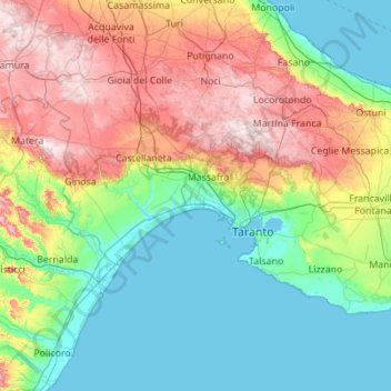
Name: Taranto topographic map, elevation, terrain.

Location: Taranto, Apulia, Italy (40.29447 16.69731 40.80325 17.80042)

Average elevation: 153 m

Minimum elevation: -2 m

Maximum elevation: 522 m

Other topographic maps

Click on a map to view its topography, its elevation and its terrain.

Brindisi

Italy > Apulia

Brindisi, Apulia, Italy

Average elevation: 80 m

Bari

Italy > Apulia > Bari

Bari, BA, Apulia, Italy

Average elevation: 64 m

Melendugno

Italy > Apulia > Melendugno > Melendugno

Melendugno, Lecce, Apulia, 73026, Italy

Average elevation: 38 m