
Thank you for supporting this site ❤️
Make a donation
Make a donation
Lod topographic map
Click on the map to display elevation.
Thank you for supporting this site ❤️
Make a donation
Make a donation
About this map
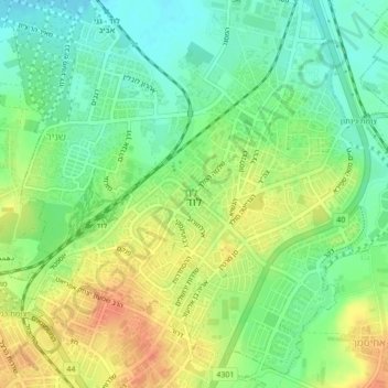
Name: Lod topographic map, elevation, terrain.
Location: Lod, Ramla Subdistrict, Center District, Israel (31.93120 34.86904 31.96808 34.90773)
Average elevation: 61 m
Minimum elevation: 41 m
Maximum elevation: 86 m
Thank you for supporting this site ❤️
Make a donation
Make a donation
Other topographic maps
Click on a map to view its topography, its elevation and its terrain.