
Thank you for supporting this site ❤️
Make a donation
Make a donation
Mineral Springs topographic map
Click on the map to display elevation.
Thank you for supporting this site ❤️
Make a donation
Make a donation
About this map
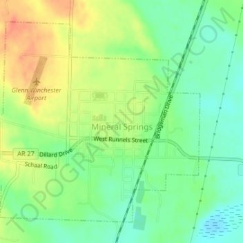
Name: Mineral Springs topographic map, elevation, terrain.
Location: Mineral Springs, Howard County, Arkansas, United States (33.86610 -93.93708 33.88839 -93.90599)
Average elevation: 103 m
Minimum elevation: 82 m
Maximum elevation: 130 m
Thank you for supporting this site ❤️
Make a donation
Make a donation
Other topographic maps
Click on a map to view its topography, its elevation and its terrain.