
Walbeck topographic map
Interactive map
Click on the map to display elevation.
About this map
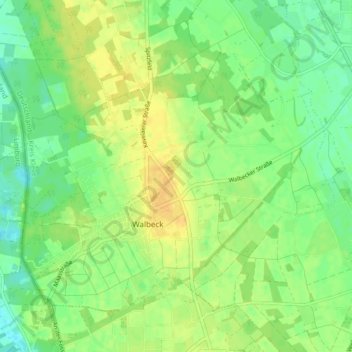
Name: Walbeck topographic map, elevation, terrain.
Location: Walbeck, Geldern, Kreis Kleve, Nordrhein-Westfalen, Deutschland (51.48323 6.20386 51.52320 6.28730)
Average elevation: 31 m
Minimum elevation: 18 m
Maximum elevation: 43 m
Other topographic maps
Click on a map to view its topography, its elevation and its terrain.
Veert
Deutschland > Nordrhein-Westfalen > Kreis Kleve > Geldern
Veert, Geldern, Kreis Kleve, Nordrhein-Westfalen, Deutschland
Average elevation: 26 m