
Thank you for supporting this site ❤️
Make a donation
Make a donation
West Cambie topographic map
Click on the map to display elevation.
Thank you for supporting this site ❤️
Make a donation
Make a donation
About this map
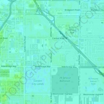
Name: West Cambie topographic map, elevation, terrain.
Average elevation: 3 m
Minimum elevation: 0 m
Maximum elevation: 9 m
Thank you for supporting this site ❤️
Make a donation
Make a donation
Other topographic maps
Click on a map to view its topography, its elevation and its terrain.
Fraser River (North Arm)
Canada > British Columbia > Metro Vancouver Regional District > Richmond
Average elevation: 27 m
Finn Slough
Canada > British Columbia > Metro Vancouver Regional District > Richmond
Average elevation: 2 m
Richmond
Canada > British Columbia > Metro Vancouver Regional District > Richmond
Average elevation: 15 m
Ketcheson Neighbourhood Park
Canada > British Columbia > Metro Vancouver Regional District > Richmond
Average elevation: 3 m
Thank you for supporting this site ❤️
Make a donation
Make a donation
Mitchell Island
Canada > British Columbia > Metro Vancouver Regional District > Richmond
Average elevation: 14 m