
Uphall Station topographic map
Click on the map to display elevation.
About this map
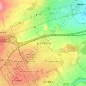
Name: Uphall Station topographic map, elevation, terrain.
Average elevation: 121 m
Minimum elevation: 59 m
Maximum elevation: 181 m
Other topographic maps
Click on a map to view its topography, its elevation and its terrain.
Linlithgow Palace and High Street Conservation Area
United Kingdom > Scotland > West Lothian > Linlithgow
Average elevation: 78 m