
Thank you for supporting this site ❤️
Make a donation
Make a donation
Jabung topographic map
Click on the map to display elevation.
Thank you for supporting this site ❤️
Make a donation
Make a donation
About this map
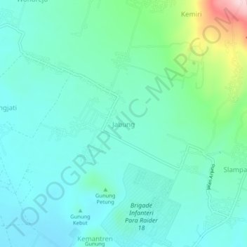
Name: Jabung topographic map, elevation, terrain.
Location: Jabung, Kabupaten Malang, East Java, Indonesia (-7.94110 112.72089 -7.90110 112.76089)
Average elevation: 573 m
Minimum elevation: 517 m
Maximum elevation: 792 m
Thank you for supporting this site ❤️
Make a donation
Make a donation
Other topographic maps
Click on a map to view its topography, its elevation and its terrain.