
Mahasu topographic map
Click on the map to display elevation.
About this map
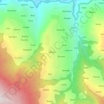
Name: Mahasu topographic map, elevation, terrain.
Location: Mahasu, Kotkhai, Shimla, Himachal Pradesh, 171202, India (31.07759 77.48659 31.11759 77.52659)
Average elevation: 2,065 m
Minimum elevation: 1,518 m
Maximum elevation: 2,825 m