
Lac de Geronde topographic map
Interactive map
Click on the map to display elevation.
About this map
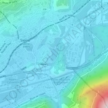
Name: Lac de Geronde topographic map, elevation, terrain.
Location: Lac de Geronde, Sierre, Valais, 3960, Suisse (46.28699 7.54086 46.29051 7.54419)
Average elevation: 602 m
Minimum elevation: 518 m
Maximum elevation: 1,410 m
La superficie du lac, situé à une altitude de 523 mètres, est de 5,5 hectares.
Other topographic maps
Click on a map to view its topography, its elevation and its terrain.