
Penanggungan topographic map
Interactive map
Click on the map to display elevation.
About this map
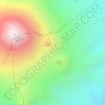
Name: Penanggungan topographic map, elevation, terrain.
Location: Penanggungan, Mojokerto, Ost-Java, Indonesien (-7.62005 112.62995 -7.61995 112.63005)
Average elevation: 913 m
Minimum elevation: 410 m
Maximum elevation: 1,639 m