
Le Hoyoux topographic map
Interactive map
Click on the map to display elevation.
About this map
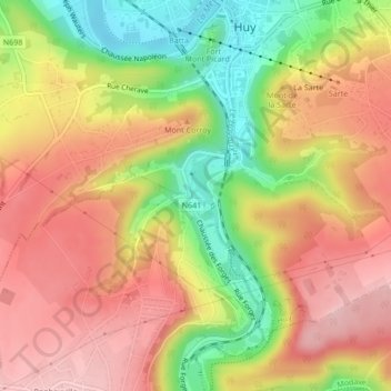
Name: Le Hoyoux topographic map, elevation, terrain.
Location: Le Hoyoux, Hoei, Luik, Wallonië, 4500, België (50.50590 5.23494 50.50694 5.23671)
Average elevation: 172 m
Minimum elevation: 65 m
Maximum elevation: 252 m
Other topographic maps
Click on a map to view its topography, its elevation and its terrain.