
Thank you for supporting this site ❤️
Make a donation
Make a donation
Maicao topographic map
Click on the map to display elevation.
Thank you for supporting this site ❤️
Make a donation
Make a donation
Maicao
The municipality of Maicao borders to the north with the municipalities of Uribia and Manaure; to the east with the Venezuela; to the south with the municipality of Albania and to the west with the municipality of Riohacha covering a total area of 1,782 km2 and at altitude over sea level of 52 m.
Thank you for supporting this site ❤️
Make a donation
Make a donation
About this map
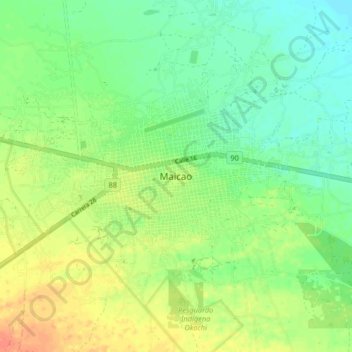
Name: Maicao topographic map, elevation, terrain.
Location: Maicao, La Guajira, RAP Caribe, 442001, Colombia (11.33731 -72.27876 11.41731 -72.19876)
Average elevation: 51 m
Minimum elevation: 34 m
Maximum elevation: 73 m
Thank you for supporting this site ❤️
Make a donation
Make a donation