Geolocate

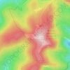
Salingueux topographic map

Click on the map to display elevation.

About this map

Name: Salingueux topographic map, elevation, terrain.

Location: Salingueux, Cornimont, Épinal, Vosges, Grand Est, France métropolitaine, 88310, France (47.93750 6.79644 47.97750 6.83644)

Average elevation: 664 m

Minimum elevation: 464 m

Maximum elevation: 983 m

Other topographic maps

Click on a map to view its topography, its elevation and its terrain.
Le Xoulces

France > Grand Est > Vosges > Cornimont

Average elevation: 865 m

REFUGE DU GRAND VENTRON

France > Grand Est > Vosges > Cornimont

Average elevation: 1,011 m