Geolocate

Bimini Bay topographic map

Interactive map

Click on the map to display elevation.

About this map

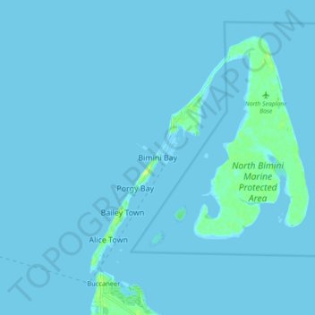
Name: Bimini Bay topographic map, elevation, terrain.

Location: Bimini Bay, Bimini, The Bahamas (25.70814 -79.32265 25.78814 -79.24265)

Average elevation: 1 m

Minimum elevation: -4 m

Maximum elevation: 19 m

Other topographic maps

Click on a map to view its topography, its elevation and its terrain.

San Salvador

The Bahamas

San Salvador, The Bahamas

Average elevation: 0 m

Great Sale Cay

The Bahamas > Grand Cay

Great Sale Cay, Grand Cay, The Bahamas

Average elevation: 0 m

Cat Island

The Bahamas > Cat Island

Cat Island, The Bahamas

Average elevation: 0 m

West Grand Bahama

The Bahamas

West Grand Bahama, The Bahamas

Average elevation: 0 m

Nassau

The Bahamas > Nassau

Nassau, New Providence, 242, The Bahamas

Average elevation: 1 m

Village Green

The Bahamas > New Providence

Village Green, New Providence, The Bahamas

Average elevation: 7 m

Half Moon Cay

The Bahamas > Cat Island

Half Moon Cay, Cat Island, The Bahamas

Average elevation: 1 m

Grand Bahama

The Bahamas > East Grand Bahama

Grand Bahama, East Grand Bahama, The Bahamas

Average elevation: 1 m

Acklins Island

The Bahamas > Acklins

Acklins Island, Acklins, The Bahamas

Average elevation: 0 m

High Cay

The Bahamas > North Abaco

High Cay, North Abaco, The Bahamas

Average elevation: 0 m

South Eleuthera

The Bahamas > South Eleuthera

South Eleuthera, The Bahamas

Average elevation: 0 m

New Providence

The Bahamas

New Providence, The Bahamas

Average elevation: 0 m

Twin Lakes

The Bahamas > Twin Lakes

Twin Lakes, The Bahamas

Average elevation: 7 m