
Sterrenberg topographic map
Interactive map
Click on the map to display elevation.
About this map
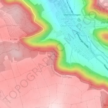
Name: Sterrenberg topographic map, elevation, terrain.
Average elevation: 613 m
Minimum elevation: 432 m
Maximum elevation: 724 m
Other topographic maps
Click on a map to view its topography, its elevation and its terrain.
Grabenstetten
Duitsland > Baden-Württemberg > Landkreis Reutlingen > Grabenstetten
Grabenstetten, Gemeindeverwaltungsverband Bad Urach, Landkreis Reutlingen, Baden-Württemberg, 72582, Duitsland
Average elevation: 661 m