
Thank you for supporting this site ❤️
Make a donation
Make a donation
Eraguene topographic map
Click on the map to display elevation.
Thank you for supporting this site ❤️
Make a donation
Make a donation
About this map
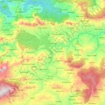
Name: Eraguene topographic map, elevation, terrain.
Location: Eraguene, Ziama Mansouriah District, Jijel, Algeria (36.51878 5.50625 36.62102 5.73613)
Average elevation: 885 m
Minimum elevation: 109 m
Maximum elevation: 1,993 m
Thank you for supporting this site ❤️
Make a donation
Make a donation