
Thank you for supporting this site ❤️
Make a donation
Make a donation
Nossen topographic map
Click on the map to display elevation.
Thank you for supporting this site ❤️
Make a donation
Make a donation
About this map
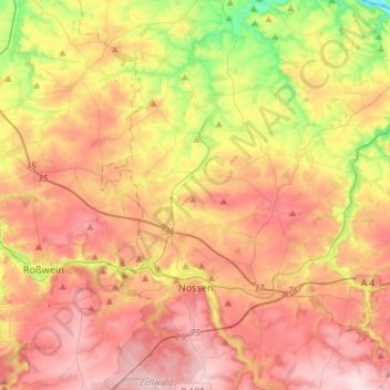
Name: Nossen topographic map, elevation, terrain.
Location: Nossen, Meissen, Saxony, 01683, Germany (51.00818 13.22711 51.19097 13.40965)
Average elevation: 243 m
Minimum elevation: 94 m
Maximum elevation: 365 m
Thank you for supporting this site ❤️
Make a donation
Make a donation
Other topographic maps
Click on a map to view its topography, its elevation and its terrain.
Thank you for supporting this site ❤️
Make a donation
Make a donation
Thank you for supporting this site ❤️
Make a donation
Make a donation