
Thank you for supporting this site ❤️
Make a donation
Make a donation
Fintry topographic map
Click on the map to display elevation.
Thank you for supporting this site ❤️
Make a donation
Make a donation
About this map
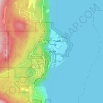
Name: Fintry topographic map, elevation, terrain.
Average elevation: 437 m
Minimum elevation: 339 m
Maximum elevation: 722 m
Thank you for supporting this site ❤️
Make a donation
Make a donation
Other topographic maps
Click on a map to view its topography, its elevation and its terrain.
Lambly Lake
Canada > British Columbia > Regional District of Central Okanagan > West Central Okanagan Electoral Area
Average elevation: 1,214 m
Christie Lake
Canada > British Columbia > Regional District of Central Okanagan > West Central Okanagan Electoral Area
Average elevation: 1,448 m