Geolocate

Billekh topographic map

Interactive map

Click on the map to display elevation.

About this map

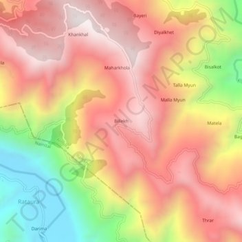
Name: Billekh topographic map, elevation, terrain.

Location: Billekh, Ranikhet, Almora District, Uttarakhand, India (29.54166 79.40047 29.58166 79.44047)

Average elevation: 1,491 m

Minimum elevation: 793 m

Maximum elevation: 1,959 m

Other topographic maps

Click on a map to view its topography, its elevation and its terrain.

Majkhali

India > Uttarakhand > Ranikhet

Majkhali, Ranikhet, Almora District, Uttarakhand, 263652, India

Average elevation: 1,662 m

Rinchi

India > Uttarakhand > Ranikhet

Rinchi, Ranikhet, Almora District, Uttarakhand, 263134, India

Average elevation: 1,669 m

Kalakhet

India > Uttarakhand > Ranikhet

Kalakhet, Ranikhet, Almora, Uttarakhand, 263663, India

Average elevation: 1,612 m