
Premploz topographic map
Interactive map
Click on the map to display elevation.
About this map
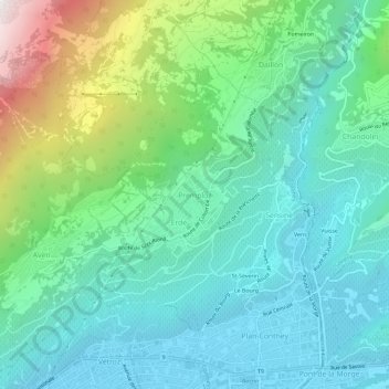
Name: Premploz topographic map, elevation, terrain.
Location: Premploz, Conthey, Valais, 1964, Suisse (46.22244 7.27399 46.26244 7.31399)
Average elevation: 893 m
Minimum elevation: 479 m
Maximum elevation: 2,162 m
Other topographic maps
Click on a map to view its topography, its elevation and its terrain.
Châteauneuf
Suisse > Valais > Conthey > Conthey
Châteauneuf, Conthey, Valais, 1964, Suisse
Average elevation: 541 m
Plan-Conthey
Suisse > Valais > Conthey > Conthey
Plan-Conthey, Conthey, Valais, 1964, Suisse
Average elevation: 600 m