Geolocate
👉 Easily get elevation data in JSON, GeoTIFF and KML formats using Elevation API
Thank you for supporting this site ❤️
Make a donation

Butterfield topographic map

Click on the map to display elevation.

👉 Easily get elevation data in JSON, GeoTIFF and KML formats using Elevation API
Thank you for supporting this site ❤️
Make a donation

About this map

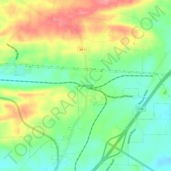
Name: Butterfield topographic map, elevation, terrain.

Location: Butterfield, Hot Spring County, Arkansas, United States (34.40731 -92.83378 34.44731 -92.79378)

Average elevation: 132 m

Minimum elevation: 92 m

Maximum elevation: 186 m

Other topographic maps

Click on a map to view its topography, its elevation and its terrain.

Malvern

United States > Arkansas > Hot Spring County

Average elevation: 101 m

Malvern

United States > Arkansas > Hot Spring County

Average elevation: 101 m