
Thank you for supporting this site ❤️
Make a donation
Make a donation
Ganeshgaon topographic map
Click on the map to display elevation.
Thank you for supporting this site ❤️
Make a donation
Make a donation
About this map
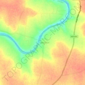
Name: Ganeshgaon topographic map, elevation, terrain.
Location: Ganeshgaon, Malshiras, Solapur, Maharashtra, India (17.92256 75.09633 17.96256 75.13633)
Average elevation: 483 m
Minimum elevation: 451 m
Maximum elevation: 501 m
Thank you for supporting this site ❤️
Make a donation
Make a donation
Other topographic maps
Click on a map to view its topography, its elevation and its terrain.