
Biga topographic map
Interactive map
Click on the map to display elevation.
About this map
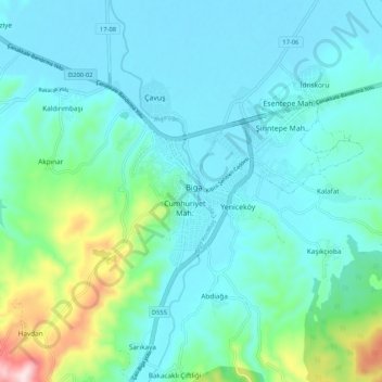
Name: Biga topographic map, elevation, terrain.
Location: Biga, Çanakkale, Marmara Region, 17200, Turkey (40.18612 27.20211 40.26612 27.28211)
Average elevation: 82 m
Minimum elevation: 15 m
Maximum elevation: 397 m