
Thank you for supporting this site ❤️
Make a donation
Make a donation
Haw Hill topographic map
Click on the map to display elevation.
Thank you for supporting this site ❤️
Make a donation
Make a donation
About this map
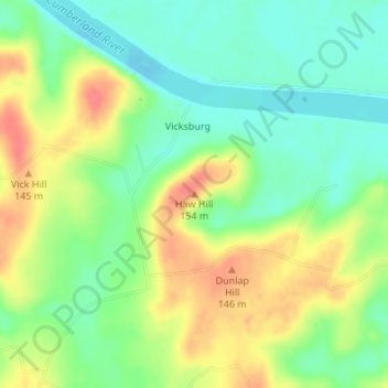
Name: Haw Hill topographic map, elevation, terrain.
Location: Haw Hill, Livingston County, Kentucky, United States (37.18056 -88.33231 37.18066 -88.33221)
Average elevation: 117 m
Minimum elevation: 91 m
Maximum elevation: 150 m
Thank you for supporting this site ❤️
Make a donation
Make a donation
Other topographic maps
Click on a map to view its topography, its elevation and its terrain.