
Thank you for supporting this site ❤️
Make a donation
Make a donation
Melavatachavady topographic map
Click on the map to display elevation.
Thank you for supporting this site ❤️
Make a donation
Make a donation
About this map
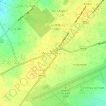
Name: Melavatachavady topographic map, elevation, terrain.
Location: Melavatachavady, Thanjavur, Tamil Nadu, 208263, India (10.71543 79.08346 10.75543 79.12346)
Average elevation: 75 m
Minimum elevation: 58 m
Maximum elevation: 84 m
Thank you for supporting this site ❤️
Make a donation
Make a donation
Other topographic maps
Click on a map to view its topography, its elevation and its terrain.