
Thank you for supporting this site ❤️
Make a donation
Make a donation
Wyler topographic map
Click on the map to display elevation.
Thank you for supporting this site ❤️
Make a donation
Make a donation
About this map
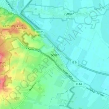
Name: Wyler topographic map, elevation, terrain.
Location: Wyler, Kranenburg, Kreis Kleve, Nordrhein-Westfalen, Deutschland (51.78852 5.94524 51.82852 5.98524)
Average elevation: 24 m
Minimum elevation: 5 m
Maximum elevation: 87 m
Thank you for supporting this site ❤️
Make a donation
Make a donation