
Thank you for supporting this site ❤️
Make a donation
Make a donation
El Tajo topographic map
Click on the map to display elevation.
Thank you for supporting this site ❤️
Make a donation
Make a donation
About this map
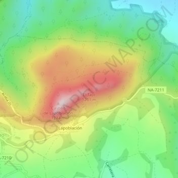
Name: El Tajo topographic map, elevation, terrain.
Location: El Tajo, Lapoblación, Montejurra, Navarra, 01118, España (42.61038 -2.45549 42.61048 -2.45539)
Average elevation: 881 m
Minimum elevation: 659 m
Maximum elevation: 1,196 m
Thank you for supporting this site ❤️
Make a donation
Make a donation